Posts

Showing posts from 2011

Kindle Once Again - this time for Walk, Hike, Saunter

Image
 Last time I did this was Dec 2017. At the moment, memory of how to do it is pretty foggy, but luckily I have my earlier blog posts on this to refresh my memory so printing them out to review. (look for Kindle label in this blog to find).  This book is a little easier than the others - text and inline photos, a table of contents, but no index. Susan has promised it will be out in two and a half weeks, so will try to do that. My immediate issue is that I remember that I have to make some changes to the Indesign file before putting out the epub file that I will update for Kindle, but don't remember quite what they were. Pausing to read my prior posts, and to review Kindle code for Healing Miles . From my 2012 notes I saw that to get reliable chapter breaks, each chapter had to be a separate xhtml file. The default of Indesign is to put out one big xhtml file, but it will break on a style, so I need to be sure the current Indesign document (for Walk, Hike, Saunter ) has an appropriat

Strive for a sane life

Image
That was my response to a Facebook friend's poll for 2012 goals.  Colored perhaps, by our immediate condition of aiding, abetting, instigating Susan's 100 (101 in Jan) year old mother's move from independent living to emergency, to rehab, and as we speak, to a assisted living facility, all over a few days time where we had no expectations other than the usual goodwill and conflict of our seasonal family gatherings. God grant me a long and happy life, followed by a painless not waking up some day. My images are of life's collections, spoons on the wall, a grandmother's stitchery, and then the spartan walls of the later stage facility. Nice, caring people, but an existence under observation  We keep hiking, maybe a little slower, but still enjoying the process. The glimpse of the life ahead is not a pleasant one.

A damp and misty morning - King Canyon Loop and Beyond

Image
California Newt - Taricha torosa, unless it is Taricha granulosa The comfort of our home has been keeping us close these days, as the fall rains roll through the area. Our walking has been curtailed, and our legs are getting more and more restless. Finally we just wrote "long walk" on the calendar, and when that day arrived, "manned up", "womaned up", put on our rain gear and went out the door, prepared for whatever the day brought. It brought wet but wonderful walking. We headed for Kings Canyon Loop, a local hike on watershed land, that has a very steep dirt down slope on the normal return path. Normally it is just a chastisement to the knees, but with wet weather turns into the slide from hell, multiple falls guaranteed, fractures likely. Considering the weather, we examined Google Maps and found an alternate return route, longer but safer. Fortunately, witches brews are less common than in Macbeth's time, so the demand for eye of newt is low

Once More, fate intervenes with our hiking

Image
I didn't expect my next post would lead with an image of Cunard Line's Queen Elisabeth, but there she is in Quebec City. We rearranged our Appalachian Trail backpack at the last minute to give flood waters from Hurricane Irene time to recede. The plan was first drive to Quebec City and Montreal and then back to Connecticut to hike its section of the AT. That part worked. This was my first visit to Quebec, and it made quite an impression on me. At an intellectual level I knew they spoke French, but had always thought of them as a part of English Canada. Now I know in my gut that this is a different place. They are so thoroughly French, not as in France, but a different French speaking country. A sign at the cathedral in Quebec City welcomed pilgrims. It wasn't till I got home that I found out that there are many pilgrimage shrines in French speaking Canada. Towards the end of our stay in Montreal, Susan had a 3am visit to McGill University Hospital emergency, where she

Trip planning again with trepidation

Image
This has been the year of weather impacted trips for us. In the spring in Spain; rain and high water forced us to cut our trip short. In August late opening trails in Glacier National Park caused a reroute which we ultimately decided was unfeasible. OK, maybe the prevalence of grizzly bears in that part of the country had something to do with it. Not to worry. There were still relatives back east, so we planned a little trip on the Appalachian Trail in time to see the fall colors. That time is soon coming. However: That little red line is about where our trip is planned. That big white thing is Hurricane Irene. We keep checking trail conditions. Words seen in reports are impassable, high water, washed away, detour, trespassing, arrested . . . , but we persevere. Flood waters drain quickly, right? We are used to crawling under and over fallen trees from our PCT days.  At least the fall colors should still be there. Is it going to be hot and miserable, cold and miserable

CDT - Southbound - Glacier National Park section hiker's reconnaissance

Image
You have a couple of choices for a southbound CDT route through Glacier. The first starts in Waterton Lakes National a Park in Canada, crosses the border at Goat Haunt, and follows the Highline trail through Glacier. This route is open at the earliest around Aug 1, as it depends on snow conditions and the Ahern Drift trail segment being blasted out. The second starts at the Chief Mountain Customs Station. The trailhead is about 50 yards south, and has a large parking lot. When we were there around 7/21 there were about 40 cars there. This route goes to Belly River, then Elisabeth Lake. After that you can go via the Ptarmagan tunnel if it is open, or the longer route via Poia Lake to Many Glacier (a resupply point with store, motel, etc.). There is not a lot of car access to the park. It is divided north south by the Going to the Sun Highway, which starts in St. Marys and ends at West Glacier. The CDT crosses this highway at two different points, depending on your route. You can pro

Passing Days

Image
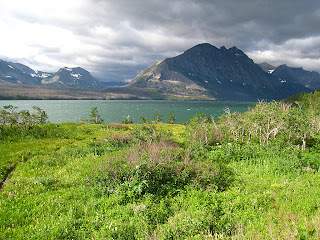
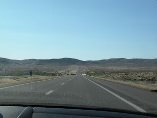
Just back from a road trip to Glacier National Park. It is in Montana and borders Canada for my European readers. The plan was to start the Continental Divide Trail. We didn't put a foot on the ground with a backpack on, but that's another story. Nowadays we Google our route options, and then use a navigation device in the car to keep us on track. Google said from Oakland, CA, go north through Spokane, WA as fastest choice, a close second was northeast over the Sierras and through Nevada. We were packed and ready to go via Spokane when a last minute check of the weather page showed the jet stream dividing the routes. Oregon Washington was all t-storms and jagged lightning symbols, the Nevada route smiling sun symbols. So, off we go, over the Sierras, through Reno, Nevada, and those little towns from my childhood, Winnemucca, Battle Mountain, Elko, Nevada, and Twin Falls, Pocatello, and Idaho Falls, Idaho. I say from my childhood, as this was the traditional route we took, f

Ohlone Wilderness Backpack - Once Again

Image
I forget (block out?),  over time, the more trying aspects of a trip. Unless, of course, it was so terrible that I have a story to tell at appropriate occasions. We have a story to tell for part of this route, that I will hold for another time, or possibly never tell. However.... We are blessed (that word has religious overtones, but I just mean an earlier, intelligent set of voters), with a vast system of regional parks, home to coyotes, foxes, mountain lions, raptors, rattlesnakes, newts, spittle bugs and beetles, to name a few. Berkeley was the scene of radical politics in the 60s, and those matured radicals still have a positive effect on their local environment, though the fuddy-duddys are gaining. I digress. The Ohlone Wilderness Trail has a segment between Del Valle Regional Park and Sunol Regional Park that is about twenty miles long. Starting from Del Valle, at about 750 feet elevation, it is ten miles to Maggie's Half Acre campsite at elevation 3480. This is by any st

Camino Mozárabe Images and Moments 2011

Image
The name was exotic, and southern Spain was unknown and beckoning. We didn't quite throw a dart at a map, but similar. It was a pilgrimage route in Europe, the length was right, we had the time. If we could deal with the heat we could do it, so number one priority was to start early enough in the year. I documented the planning in an earlier blog entry: Camino Mozárabe - Planning - a work in progress    At first we picked April 17 as a start date in Granada. Then I reread James Michener's Iberia  - Easter is a huge deal in Granada, no chance of finding reasonable accommodations at this late date, plus it would be crazy to be there at Easter and then leave without experiencing the whole Easter week. So, we moved the date to April 27th. Got to Málaga saw a few sights, slept, and caught the bus to Granada. Pouring rain on the bus, but just showers by the time we arrived around noon. Into the hotel to drop our stuff and then out. Found where the Camino Mozárabe route started. (Mark

How many years does it take before abandoned objects become art?

Image
I often find myself photographing the old and broken down, but it requires a number of years of aging to get the proper amount of rust, enough broken windows, or whatever symbolizes the conquest of nature over our small efforts. We are in that cautious hiking stage where a trip is soon enough that we don't have time to heal if we do serious hurt to ourselves through improvident exertions. A couple of weeks ago we did the falls loop on Mt. Diablo and managed to stress Susan's knees, so since then have kept walking, but on flatter terrain. This walk was through Round Valley Preserve, a ranch purchased by an Irish immigrant, Thomas Murphy, in 1873, and finally sold by his grandson in 1988 to the East Bay Regional Park District for open space. Our route kept to the valley floor, just right for healing knees. Here and there as we passed along, were rusty pieces of farm equipment, sitting or fallen in their place of last use. Some examples: There were of course, numerous fl